2019 New Zealand - Campervan 4 Milford Sound
First, the last (a reflection)
 |
| An ending photo of Milford Sound |
The Milford Sound Road
Leaving Te Anau I had an audio guide to talk to me about the region, its history and the sights to see. A very helpful commentary that had me play and then pause as landmarks were reached.Lake Te Anau - as I drive out


Eglinton Flats
The next highlight was Te Anau Downs but really only for its history - no photos. Then at the 50km mark was a viewpoint for Eglinton Flats. This was Knobs Flat which had a sunlit field of Eglinton Valley but that ended just after a single photo to a much darker photo:

Milford Track
Somewhere (which I dit not pinpoint) is the start of the famous Milford Track... I did not pinpoint it as I had no intention of suffering the beauty it can represent over an extended 4 day hike ;-> The route was one of a network of trails familiar to the Maori but unknown to the first European arrivals. In the late 1800s, however, growing tourist interest in Milford’s spectacular scenery increased the pressure to find an overland link between Te Anau and Milford Sound/Puopiotahi. In 1888 Quintin Mackinnon succeeded in cutting a track from Te Anau, over Mackinnon Pass and descending towards Milford where he connected to a trail blazed by Donald Sutherland.Mirror Lakes


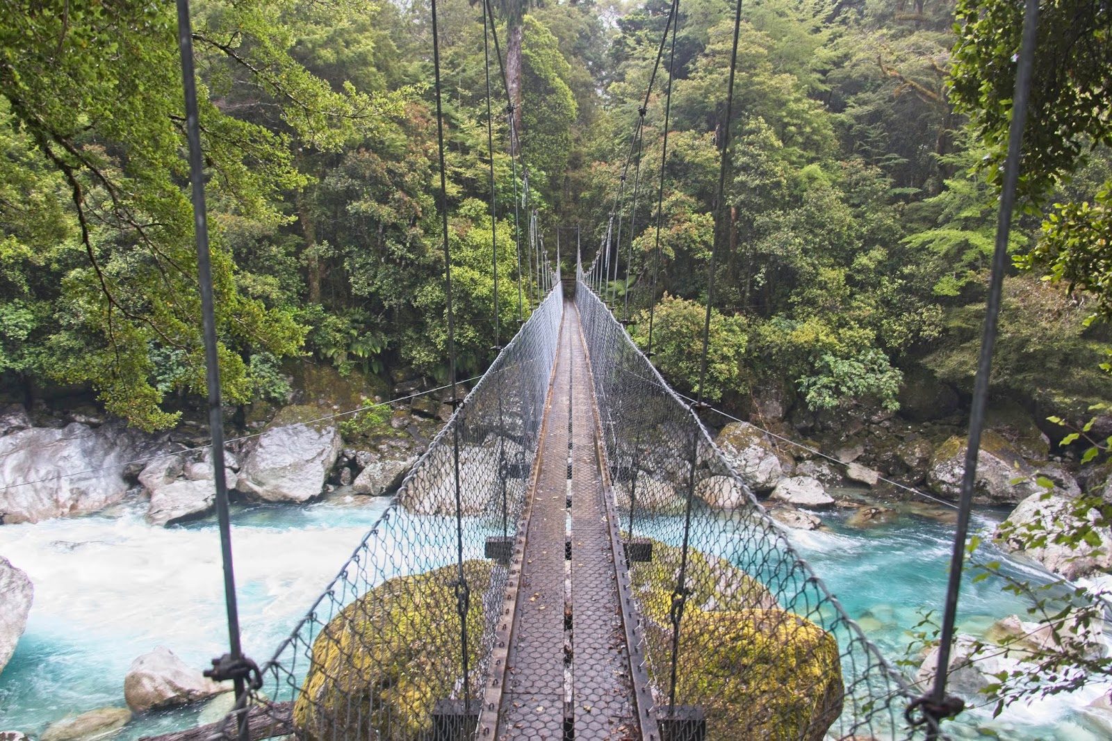
Humbolt Falls, Moraine Creek, and Gunn's Camp
After driving past a few lakes and The Divide (starting point of the Routeburn, Greenstone & Caples tracks) I took the Hollyford Road turn off to see Humbolt Falls. The road dead ends for vehicles and has a couple more tracks for people to follow. After a short hike to the falls I returned to main road, stopping off at Moraine Creek and its suspension pedestrian bridge, and a quick photo shoot at Gunn's Camp (still in use - but a remnant of the past in opening Milford Sound).


Homer Tunnel
Somewhere before Homer Tunnel I was able to photograph my first Keas (thieving intelligent but almost extinct New Zealand Birds - notice given that they know humans have food and will get angry if you tease them!).


The Chasm
After Homer Tunnel the first stop I did was for The Chasm. A very short walk to thundering water flowing through a rocky bed.


Milford Sound
“Piopiotahi,” the Māori name given to Milford Sound, means thrush or place of the singing thrush. Legend states that when Māori lost the treasure of immortality for mankind to the goddess of death, Hine Nui Te Po, a thrush flew into Milford Sound to sing and mourn the loss.

No wifi... no cell phone signal! Withdrawal symptoms with down time in all this rain! The front desk warned that the forecast was for torrential rain overnight but then clearing.
This first day I did a walk of the foreshore of Milford Sound and have a few photos featuring Variable Oystercatchers that I'm going to share. Later I did the second walk with stunning photos - read on....


Southern Discovery Cruise
The captain informed us that we had 196mm rain overnight! It was still raining but at least the winds decreased. The accumulation of rain has meant that the waterfalls are AWESOME! We were informed that they are more awesome than normal.


A highlight was the up close and personal position the boat took at Smith Falls. Those brave/foolish enough to stand on the foredeck got the "glacial facial"

The cruise portion was a good hour and forty five minutes, pulling in at Harrison Cove to drop of those of us doing the Underwater Observatory.


I did Underwater Discovery first with the crowd from my boat, and then 15 minutes alone after they left and before the next boat pulled in. In 1978 a scientific survey revealed what local divers had known for years - life beneath Fiordland waters was truly unique. From this the idea of an underwater observatory was born. Harrison Cove was selected for minimizing dangers: wind tunnels, howling gales, and avalanches. Also it needed to rise and fall with the tides and still be close enough to the fiord wall to allow for close study. Harrison Cove is a flooded hanging valley that opens onto the main fiord, and with depths below the observatory dropping away to 100 meters it is also the shallowest area in the fiord. The story is that the combination of water depth with large fresh water layer from all the rains results in aquatic live living closer to sea level than you would find anyway else.
The winds died, the sun came out and so did the infamous sandflies! But spectacular views (some with reflections).


